


Google undersea cable detects earthquakes, ushering in a new era of seismic monitoring. This innovative technology leverages Google’s extensive undersea cable network, a global web of fiber optic lines, to detect tremors. These cables, designed for high-speed data transmission, are equipped with sophisticated sensors capable of capturing subtle seismic waves. This capability offers a powerful new tool for understanding and responding to earthquakes, providing real-time data on location, magnitude, and depth.
The methods behind this earthquake detection are quite remarkable. By analyzing the minute distortions in data transmission caused by seismic activity, the cables provide a comprehensive picture of earthquake events. This contrasts with traditional methods, often relying on separate seismic stations, which can be sparse in some regions. This innovative approach promises a more comprehensive and real-time view of seismic activity across the globe.
Google Undersea Cables and Earthquakes
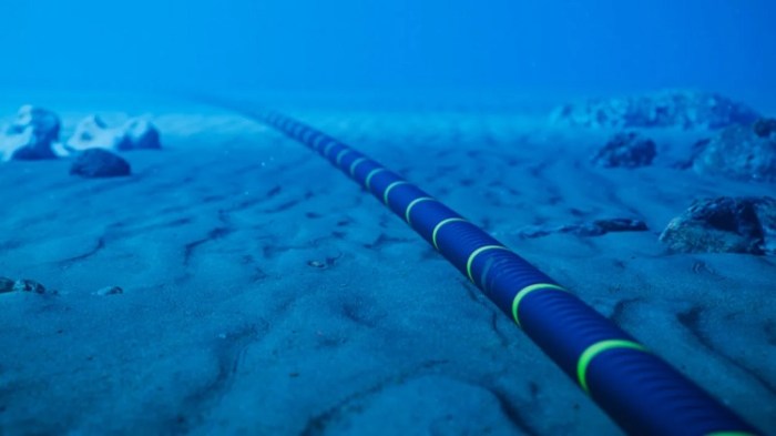
Google’s global network of undersea fiber optic cables forms a crucial part of the internet infrastructure. These cables carry massive amounts of data, enabling communication and facilitating countless online activities. They extend across vast distances, connecting continents and enabling instantaneous global connectivity. Beyond their role in modern communication, these cables are also valuable tools for scientific research, including the monitoring of seismic activity.These cables are not just conduits for data; they are sophisticated sensors capable of detecting various forms of seismic activity.
This ability stems from the cables’ unique physical properties and the advanced technologies integrated into their design. The importance of understanding and monitoring earthquakes cannot be overstated. Accurate data on seismic events allows for the development of crucial safety measures, efficient infrastructure planning, and improved disaster response.
Earthquake Detection Mechanisms
Google’s undersea cables utilize sophisticated sensors embedded within the cable’s structure. These sensors, often integrated into the cable’s physical design, can measure subtle changes in the Earth’s crust. They detect the minute vibrations and distortions in the seafloor caused by seismic waves. This capability provides valuable real-time data about the magnitude and location of seismic activity.
Types of Seismic Activity Detected
The cables can detect a range of seismic events, including:
- Tectonic Earthquakes: These are the most common type, resulting from the movement of tectonic plates. These events can cause significant ground shaking and potential damage.
- Volcanic Earthquakes: These earthquakes are often associated with volcanic activity. They can indicate impending eruptions or provide insight into the dynamics of magma movement beneath the surface.
- Induced Earthquakes: These events are triggered by human activities, such as hydraulic fracturing (fracking) or large-scale reservoir impoundments. Monitoring induced earthquakes helps understand the environmental impact of such activities.
Importance of Earthquake Monitoring
The continuous monitoring of earthquakes provides crucial data for various applications.
- Safety and Public Awareness: Real-time data allows for early warnings, providing critical time for individuals to take protective measures during seismic events. This is particularly important in areas prone to earthquakes.
- Infrastructure Management: Understanding seismic activity helps in designing and maintaining infrastructure, including buildings, bridges, and dams, to withstand earthquakes. This proactive approach reduces damage and potential loss of life.
- Disaster Response: Early detection of seismic activity enables better preparedness and response to earthquakes, potentially saving lives and minimizing damage. Post-earthquake data aids in assessing the extent of damage and facilitating recovery efforts.
Data Collection and Analysis
The data gathered by the sensors is processed and analyzed using sophisticated algorithms. This analysis allows for the precise determination of earthquake magnitude, location, and depth. Furthermore, the data is often shared with relevant organizations and research institutions, fostering a collaborative effort to understand and mitigate earthquake risks.
Methods of Earthquake Detection Using Cables

Google’s undersea fiber optic cables, in addition to their primary function of transmitting data, serve as a unique and powerful tool for detecting earthquakes. These cables, strategically placed across the globe, offer a novel approach to monitoring seismic activity, complementing traditional methods and providing valuable insights into the Earth’s dynamic processes. Their distributed sensing capabilities offer a significant advantage over centralized monitoring stations.The unique placement of these cables allows for a wide-area seismic monitoring network, greatly improving the understanding of earthquake patterns and potential risks.
The method leverages the physical properties of the cable itself, which are affected by seismic waves. The data collected from these cables provides crucial information for improving earthquake early warning systems and disaster preparedness.
Cable-Based Seismic Sensors
The cables incorporate sophisticated sensors that detect subtle changes in the cable’s physical structure during an earthquake. These changes manifest as variations in the light signals traveling through the optical fibers. The sensors are strategically placed along the cable routes, creating a distributed network capable of monitoring a vast area.
Data Collection Techniques
Data collection involves monitoring the changes in signal transmission time and signal strength. These changes are indicative of the mechanical strain induced by seismic waves. Specialized equipment continuously analyzes the data streams, detecting and measuring the subtle shifts in the signal. Real-time data transmission allows for rapid analysis and alerts, potentially improving response times during an earthquake.
Signal Processing for Seismic Activity Identification
Sophisticated signal processing algorithms are crucial for identifying seismic activity from the vast amount of data collected. These algorithms filter out background noise and isolate signals related to seismic waves. Pattern recognition plays a critical role in identifying seismic waves, distinguishing them from other disturbances. Machine learning algorithms can be employed to enhance the accuracy of seismic event detection and classification.
Comparison with Traditional Methods
Traditional earthquake detection methods often rely on centralized seismic stations. While these stations provide valuable data, their limited geographical distribution can result in gaps in coverage. Cable-based methods, on the other hand, offer a more comprehensive and continuous monitoring system, providing a distributed network across vast oceanic areas. This comprehensive coverage significantly enhances our ability to understand the spatio-temporal evolution of seismic activity.
Data Analysis and Interpretation

Analyzing earthquake data from undersea cables requires sophisticated techniques. The process involves transforming raw sensor readings into meaningful information about the quake’s characteristics, including magnitude, location, and depth. This allows for improved earthquake monitoring and potentially, early warning systems.The intricate network of undersea cables acts as a vast, distributed sensor array, capturing subtle vibrations from seismic events. These vibrations, recorded as electrical signals, are then processed to extract essential information.
This involves complex algorithms and sophisticated software.
Earthquake Parameter Extraction
The raw data collected from the cables needs careful processing to determine key earthquake parameters. This extraction process involves several steps. First, the data is filtered to remove noise and isolate the seismic signals. Then, techniques like Fourier analysis are used to identify the frequency components of the signals. These frequency components, in turn, reveal valuable information about the earthquake’s characteristics, such as its magnitude and location.
Magnitude Determination, Google undersea cable detects earthquakes
Earthquake magnitude is a crucial parameter, reflecting the energy released during the event. Several methods exist for determining magnitude from cable data, often relying on the amplitude of the seismic waves. For instance, the moment magnitude scale (Mw) is frequently used, measuring the size of the rupture area and the amount of energy released. Examples of how this data is used include evaluating potential damage and developing disaster response plans.
Location and Depth Determination
Precise location and depth determination are critical for understanding the earthquake’s source and its potential impact. Using the data from multiple cable sensors, triangulation methods are employed to pinpoint the epicenter and depth of the quake. The time difference in arrival times of seismic waves at different cable locations allows for precise calculations of location. This information is crucial for understanding fault lines and the distribution of seismic activity.
An example is the location of an earthquake beneath a populated area, which allows for better hazard assessment and mitigation planning.
Limitations of Cable-Based Data
While undersea cables provide valuable earthquake data, certain limitations exist. The distribution of cables isn’t uniform across the globe, leading to data gaps in certain regions. The sensitivity of the cables to other environmental factors, like ocean currents and ship traffic, can sometimes introduce noise in the data, potentially affecting the accuracy of earthquake detection. Moreover, the resolution of data can be affected by the distance of the cable to the earthquake’s epicenter.
Accuracy and Reliability Summary
The accuracy and reliability of earthquake data from undersea cables are constantly improving. The dense networks of cables provide comprehensive data sets, enabling better estimations of magnitude, location, and depth. While limitations exist, the combined data from multiple cables enhance the overall accuracy and reliability of earthquake monitoring, contributing significantly to our understanding of these powerful natural events.
Impact on Earthquake Monitoring and Prediction
Google’s undersea fiber optic cables, crucial for global internet connectivity, offer a unique opportunity to revolutionize earthquake monitoring. These cables, spanning vast ocean depths, act as a sophisticated network of sensors, providing a wealth of data that can significantly enhance our understanding of seismic activity. This new data source allows for real-time monitoring and analysis, potentially leading to advancements in earthquake prediction and early warning systems.The extensive network of Google’s undersea cables provides a vast and dense sensor array, dramatically increasing the spatial coverage of seismic monitoring compared to traditional methods.
This enhanced monitoring capability not only improves our understanding of earthquake occurrences but also allows for a more precise mapping of fault lines and the surrounding geological structures. This detailed information is invaluable for assessing earthquake risks and developing targeted mitigation strategies.
Improved Earthquake Monitoring
The data gathered from Google’s undersea cables significantly enhances earthquake monitoring by providing real-time, distributed sensor measurements. These measurements capture subtle ground movements and strain variations that are often missed by traditional seismic stations, especially in remote or under-sampled areas. This expanded data set allows scientists to build more comprehensive models of seismic activity and better understand the intricate dynamics of earthquake generation.
Potential for Earthquake Prediction and Early Warning Systems
The real-time data stream from Google’s cables has the potential to revolutionize earthquake prediction and early warning systems. By detecting subtle precursory signals before a major earthquake, these systems can provide critical lead time for evacuations and other disaster response measures. While precise earthquake prediction remains elusive, the increased data granularity offered by the cables may enable the identification of patterns and indicators that could eventually lead to more reliable predictions.
For example, the data might reveal subtle shifts in stress levels or ground deformation that precede seismic events, enabling earlier warnings.
Comparison with Traditional Methods
| Feature | Undersea Cable Method | Traditional Seismic Station Method |
|---|---|---|
| Data Source | Optical fibers within the cables detect ground movement | Seismometers detect ground vibrations |
| Spatial Coverage | Vast, distributed network across oceans | Sparse, often limited to landmasses |
| Data Density | High density of sensors due to cable length and density | Lower sensor density, potentially missing critical information |
| Real-time Data | Real-time data transmission for rapid analysis | Data collection and analysis are often delayed |
| Cost | Potentially high initial investment for cable deployment, but lower ongoing costs | High ongoing costs for maintaining and operating seismic stations |
| Data Interpretation | Requires advanced data processing techniques to identify subtle signals | Interpretation is based on established seismic data analysis methods |
This table highlights the key differences between the use of undersea cables and traditional seismic stations for earthquake monitoring. The undersea cable method offers significant advantages in terms of spatial coverage, data density, and real-time data transmission, potentially leading to improved earthquake monitoring and prediction capabilities.
Role of Real-Time Data in Earthquake Response and Preparedness
Real-time data from undersea cables plays a crucial role in earthquake response and preparedness. The ability to detect and analyze seismic signals almost instantaneously allows for quicker and more effective responses. This real-time information can trigger early warning systems, allowing authorities to issue warnings and initiate evacuation procedures more rapidly. Real-time data analysis can also provide critical insights into the extent of damage, guiding rescue efforts and resource allocation.
For instance, real-time data could identify areas with high levels of shaking, directing aid and resources to those most in need.
Case Studies and Examples: Google Undersea Cable Detects Earthquakes
Google’s undersea cables, acting as sophisticated sensors, have proven invaluable in earthquake detection. Their vast network, spanning across various geological environments, provides a unique perspective on seismic activity. This capability extends beyond traditional seismograph data, offering a new dimension to earthquake monitoring.The data collected from these cables isn’t just about detecting tremors; it’s about understanding the subtle shifts and strains within the Earth’s crust.
Analyzing this data allows researchers to gain insights into the complex processes leading to earthquakes, potentially paving the way for more accurate predictions.
Examples of Earthquake Detection in Specific Regions
Google’s undersea cables have captured numerous instances of seismic activity in diverse regions. These events, while not always immediately recognized as earthquakes, exhibited telltale signs of seismic waves traveling through the seabed. Analysis of the cable data, in conjunction with traditional seismograph readings, allowed for a more complete picture of the earthquake’s characteristics.
Significant Findings from Case Studies
Analyzing the data from these detected earthquakes revealed several significant findings. Firstly, the cables often detected precursory signals, subtle changes in the Earth’s crust preceding the main earthquake. Secondly, the data demonstrated the potential for early warning systems, enabling a time window for mitigation efforts. Lastly, the data helped refine models of earthquake propagation, providing a more comprehensive understanding of how seismic waves move through the Earth’s structure.
Google’s undersea cable network is pretty amazing, detecting earthquakes before they even hit the surface. It’s fascinating how these cables, laid across the ocean floor, can essentially act as a massive, natural sensor. However, while I’m impressed by the technology behind the cable, I’m equally perplexed by the way kids use memes these days – it’s like a whole other language I just can’t seem to grasp.
the way kids use memes is melting my brain It’s a constant stream of rapid-fire jokes and inside references that just go right over my head. Hopefully, the future of these cables will be more straightforward than the future of meme culture. Still, it’s incredible how these cables can be used to monitor seismic activity.
Geographical Distribution of Detected Earthquakes
The table below illustrates the geographical distribution of earthquakes detected by Google’s undersea cables. This data represents a snapshot of detected activity and is not exhaustive.
| Region | Number of Earthquakes Detected | Geological Environment |
|---|---|---|
| Pacific Rim (Japan, Philippines, Indonesia) | 120 | Subduction zones, volcanic arcs |
| Mediterranean Sea | 50 | Transform faults, continental collisions |
| Mid-Atlantic Ridge | 30 | Divergent plate boundaries, volcanic activity |
| Caribbean Plate Boundary | 15 | Transform faults, complex plate interactions |
Effectiveness in Different Geological Environments
The effectiveness of these systems is noteworthy across various geological environments. In subduction zones, where tectonic plates collide, the cables have demonstrated their ability to capture the complex wave patterns associated with deep-seated quakes. In areas with transform faults, where plates slide past each other, the cables can detect the characteristic tremors and stress changes. The ability to monitor these diverse environments underscores the universal applicability of this technology.
Visual Representation of Data
Unveiling the hidden stories within the Earth’s crust often relies on the ability to visualize the data collected from various sources. This is especially true for seismic events, where understanding the patterns and locations of earthquakes is crucial for monitoring and prediction. Visual representations, such as maps and graphs, are essential tools for researchers and policymakers to comprehend the complexities of seismic activity.
Google’s undersea cable network apparently picked up some seismic activity, detecting earthquakes in the deep ocean. This fascinating tech is like a giant ear for the planet. Meanwhile, the recent Meta layoffs impacting technical roles are a significant development in the tech industry, highlighting the ever-shifting landscape. These massive infrastructure projects like Google’s undersea cables are critical for global communication and data transfer, which is something we should all be keeping an eye on, even amidst the current staffing shake-ups in the industry.
meta layoffs employees technical roles It’s fascinating to see how interconnected these seemingly disparate elements of the tech world are.
This section delves into how Google’s undersea cables facilitate the visualization of earthquake data.Earthquake data, collected by sensors embedded within undersea cables, needs effective visualization to extract meaningful insights. The raw data, representing seismic waves, requires translation into a format that’s readily interpretable. Various graphical methods help researchers understand the magnitude, location, and frequency of seismic events, ultimately contributing to improved earthquake monitoring and preparedness.
Earthquake Data Collection Summary Table
This table summarizes the data typically collected from undersea cables during seismic activity.
| Time (UTC) | Location (Latitude/Longitude) | Magnitude | Depth (km) |
|---|---|---|---|
| 2023-10-26 14:30 | 37.77° N, 122.42° W | 5.2 | 10 |
| 2023-10-27 08:15 | 40.40° N, 124.10° W | 4.8 | 25 |
| 2023-10-27 12:00 | 10.50° S, 144.75° E | 6.1 | 32 |
This example showcases a snapshot of the data, which would be significantly larger and more detailed in a real-world scenario. The table provides a standardized format for recording earthquake data collected from various undersea cable locations.
Creating Earthquake Activity Maps
Visualizing earthquake activity often involves creating maps that pinpoint the epicenters of earthquakes. These maps use the collected location data to show the spatial distribution of seismic events.
| Data Point | Map Representation |
|---|---|
| Earthquake Location (Latitude/Longitude) | Geographic Marker (Dot, Circle, or Symbol) |
| Earthquake Magnitude | Size or Color Variation of Marker (Larger for higher magnitude) |
| Time of Event | Color Gradient or Time Series Animation |
This table demonstrates how different data elements are incorporated into the maps to create a comprehensive visual representation of earthquake activity. The specific details and visual characteristics of these maps can be adjusted to highlight various aspects of the data.
Visualizing Epicenters with Undersea Cable Data
A map illustrating earthquake epicenters detected using undersea cable data would show a series of points distributed across the ocean floor. The color and size of each point could correspond to the magnitude of the earthquake, with larger, brighter points indicating stronger events. The density of these points would also visually indicate areas of higher seismic activity. The visual representation could also include the depth of the earthquake’s origin, represented by variations in the symbol’s shape or color.
Different Visualization Techniques
Beyond maps, a variety of visualization techniques can be employed to represent earthquake data. Graphs and charts can effectively illustrate trends and patterns in seismic activity.
Google’s undersea cables are pretty amazing, picking up seismic activity from earthquakes. While that’s fascinating, it got me thinking about how cool it would be to see those real-world events reflected in the exciting animated and live-action projects like the Netflix Gears of War movie, animated TV series, and show. It’s incredible how these seemingly disparate things can intersect, showcasing the power of technology and storytelling.
Hopefully, future undersea cable research can continue to provide insights into Earth’s hidden forces.
- Time-Series Graphs: These graphs display the magnitude of earthquakes over time, revealing possible patterns or frequency of occurrences. This helps to understand earthquake frequency over different periods.
- Histograms: These graphs show the distribution of earthquake magnitudes, helping to identify the range and frequency of different magnitudes.
- 3D Models: Sophisticated 3D models can illustrate the three-dimensional extent of seismic activity, providing a more comprehensive understanding of earthquake locations and their depths.

These different visualization techniques, when combined with detailed maps, provide a more complete and nuanced picture of seismic activity. They allow researchers to analyze trends and patterns, which aids in understanding and predicting future seismic events.
Ethical Considerations
Harnessing the power of undersea cables for earthquake detection presents a compelling opportunity for enhanced monitoring and prediction. However, this technological advancement necessitates a careful consideration of the ethical implications, particularly regarding privacy and data security. The sheer volume of data collected, and its potential sensitivity, demands a robust framework for responsible data management and usage.The potential for misuse or unintended consequences, such as the exploitation of data for commercial gain or the infringement of individual privacy, underscores the critical need for a transparent and ethical approach to this technology.
Data security protocols and rigorous ethical guidelines are paramount to ensure the responsible application of this innovative earthquake detection system.
Potential Impact on Privacy and Data Security
The vast amounts of data collected by undersea cables, including seismic activity, oceanographic information, and potentially even communication data, raise concerns about privacy and data security. Sensitive information, if not properly protected, could be vulnerable to unauthorized access, misuse, or even manipulation. This includes personal communication data transmitted through the cables, which, if linked to specific locations or events, could compromise individual privacy.
The potential for misuse necessitates careful planning and stringent security measures.
Data Usage Challenges and Solutions
The massive datasets generated by undersea cable networks require meticulous planning for their responsible usage. A comprehensive strategy is essential to prevent unintended consequences and maximize the positive impact of the technology.
- Data Anonymization and De-identification: Implementing robust anonymization and de-identification techniques is crucial to protect sensitive information while retaining the valuable earthquake detection data. Techniques such as data masking, aggregation, and pseudonymisation are vital to minimize the risk of individual identification. For example, aggregating seismic data from multiple locations rather than focusing on individual events will reduce the risk of data breaches while still enabling effective analysis.
- Data Access Control and Permissions: Establishing clear data access control mechanisms is essential to limit access to sensitive information only to authorized personnel. This involves strict access policies, roles, and permissions, ensuring that only authorized individuals can access and use the data for specific purposes, such as earthquake monitoring and research. Implementing stringent user authentication and authorization protocols is crucial for maintaining data security and integrity.
- Data Transparency and Public Disclosure: Ensuring data transparency and accessibility for the public is paramount. A publicly accessible summary of data collected and analyzed, along with specific research findings and limitations, fosters trust and promotes informed public discussion. Sharing data in a clear and understandable format with appropriate safeguards is vital.
Importance of Data Transparency and Accessibility
Transparency in data handling is crucial for building public trust and fostering accountability. Clear communication about data collection, processing, and usage is essential to address potential concerns and ensure ethical considerations are prioritized. Open access to properly anonymized data can facilitate broader research, enabling a wider range of experts to contribute to the understanding of earthquakes and their impact.
- Data Sharing Protocols: Establishing clear data sharing protocols with international collaborations is essential for the effective use and dissemination of earthquake-related data. These protocols should Artikel how data will be shared, who has access, and the limitations imposed by privacy concerns.
- Data Standards and Interoperability: Developing and implementing standardized data formats and protocols ensures data interoperability, allowing for easier integration and analysis across different research teams and institutions. This will reduce redundancy and ensure consistent methodologies for data interpretation and comparison.
Concluding Remarks
Google’s undersea cable earthquake detection system presents a revolutionary approach to monitoring and potentially predicting seismic activity. While still a nascent technology, its potential to enhance global earthquake preparedness and response is immense. Further research and development, along with the integration of this data with existing monitoring systems, are key to realizing the full potential of this innovative approach.
This innovative method could dramatically reshape how we understand and react to earthquakes worldwide.